Las Vegas PRIDE OUTside
Las Vegas PRIDE is excited to present a monthly event for all ages! We proudly present PRIDE OUTside each month when, as a group, we meet in the great outdoors for fun activities.

General Information
Las Vegas PRIDE is excited to present this monthly event for all ages! With PRIDE OUTside, we invite you to join us each month as we meet in the great outdoors for fun activities.
Our meeting place may change each month, please pay special attention to the locations outlined on this page. Our event will provide free participation to all and will be inclusive of all ages. Please bring your own snacks and plenty of water to stay hydrated for this event. Participate at your own pace and risk.
KNOW YOUR LIMITS.
Our organizers are not tour guides, we’re not rangers. Going hiking with us is the same as going hiking with a few friends. Think safety, expect the same risks, take the same precautions. If you’re a beginning hiker, a hike’s elevation and distance may not mean much to you. Likewise, difficulty ratings are subjective, and a hike that is “easy” to one person may be “moderate” to another. This is casual hiking, as you go on more hikes with us, you’ll learn more about your own limits. Ultimately, it’s up to you to keep yourself safe out there. You’re an adult. Hike within your abilities.
DUES/FEES
There are no membership dues to be a part of this group.
LET’S KEEP THIS SIMPLE
- Everyone is welcome
- We hike together
- We come prepared
- We’re all adults- please respect one another
- We appreciate the outdoors; please control your own trash
- Have fun! Enjoy your day, that’s what this is all about
Be Prepared, Safety First!
Seven Essentials List — a list of seven “always-have-’em” items first developed by outdoor clubs in the 1930s. Of course, many want to know if there are any items we can skip on our casual short day hikes…
The overly cautious and responsible answer is that yes, you should take everything with you all the time. The reason most accidents happen is because people weren’t prepared to deal with a situation on the trail, or that they didn’t know how to deal with an accident or injury once it occurred.
1. Map – NECESSARY: Never, ever, ever leave home to hit the trail without having a map of the area in your bag. A physical, paper map is absolutely essential to anyone spending time in the wilderness – they’ll help you if you get lost, they’ll help you locate landmarks and options if a route is closed or more difficult than you thought, and you don’t have to worry about batteries running out. Of course, it’s not good enough to have a map – you have to have a good topographical map – not just a sketched out diagram from the web – and you have to know how to read it.
2. Compass, Supplemented with a GPS Receiver – OPTIONAL / NECESSARY: It would be great to take a GPS receiver with you, that would be mainly use for keeping track of trails. If you’re not confident in your cartography skills, compasses are cheap and light, and you should consider them necessary.
3. Sunglasses and sunscreen – NECESSARY: A decent pair of polarizing lenses will do wonders for you. Not only will they prevent sun glare, but they’ll also shield your eyes from drying winds AND errant branches and brush. Sunscreen is ALWAYS important, even on cloudy days. You’re going to be spending a few hours outside in direct sunlight, and you’re probably going to be sore the next day. You don’t want to have a sunburn, too.
4. Extra food and water – NECESSARY: … to a point. I don’t pack full MRE’s for a casual 2 to 3 hour day hike, but it is always wise take a few energy bars or pieces of fruit Always take more water than you plan on drinking, too. It adds a little bit of weight to your pack, but if you spend more time on the trail than you were planning to, you’re going to be thankful.
5. Extra clothes- NECESSARY: … again, to a degree, dress in layers, you can remove your top layer if it’s feeling warm at the trailhead. But it’s nothing too fancy — a fleece pullover for the top, a hat and gloves, and convertible pants would be considering dayhike “extra clothes.”
6. First aid kit – NECESSARY: This is another never-leave-home-without-it item for me. A lightweight medkit from REI that came with gauze, bandaids, tweezers, a signal whistle, antihistamines, painkillers, and all sorts of other goodies. We recommend supplemented it with some duct tape, chewable pepto bismol, some hand warmers, blister bandagaes, and a few other items, and have actually used it quite a bit on the trail – mostly for minor things. If you get a headache in the middle of the woods, that hike back to the car gets a lot nicer when you’ve got aspirin to take. Also, you’ll look like a hero if you come upon someone who has a cut or sprain and doesn’t have a kit. Well worth the money.
7. Knife – RECOMMENDED: A Swiss Army Knife is perfect; you’ll rarely use it. Still, the potential uses for a knife are pretty strong, so it’s probably worth taking one along.

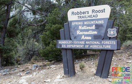
About our Destinations
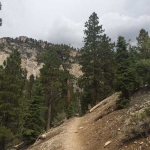
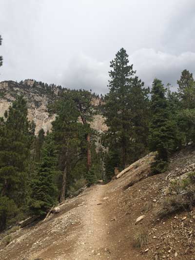
The Cathedral Rock trail begins in Mazie Canyon with ponderosa and white fir, but soon nears aspen. In the summer, this is one of the most colorful areas when the wildflowers are blooming and the butterflies are fluttering. It is a major avalanche path in the winter. About halfway up the trail is a waterfall just off the trail with a short, old road leading to it. As the trail goes up out of the canyon toward the back of Cathedral Rock one gets a view of the avalanche chute below. The trail climbs a few short, steep switchbacks before reaching the summit, with a spectacular view of Kyle Canyon.
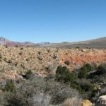
Calico Basin is a colorful desert area tucked between the gray limestone La Madre Mountains to the north, the red sandstone Calico Hills to the west, and a desert ridge to the south. Three springs with permanent water emerge from the base of the red and white sandstone cliffs: Red Spring, Calico Spring, and Ash Spring. Water also emerges from several seeps in the area, and water runs in washes to the north and south of the springs area during winter. The springs support trees, thickets, and an open meadow. Compared to the surrounding desert, Calico Basin is sheltered and moist, and it is easy to understand why native birds, and wildlife spend time here.
Location
The Calico Basin Picnic Area is located in the Red Rock Canyon National Conservation Area, about 30 minutes from downtown. View a Google Map of this Location.
From town, drive out to Red Rocks. From Charleston Blvd at Highway I-215 (Table 1, Site 0516), drive west on Charleston Blvd for 3.8 miles (about 1.5 miles before the entrance to the Scenic Loop) to Calico Basin Road. Turn right onto Calico Basin Road and follow it past all of the other picnic areas and trails. The Kraft Mountain Loop parking area is at the end of the Calico Basin Road. Once you have parked, meet the group at the Kraft Mountain Loop trailhead.
Hours
The Calico Basin area has posted hours and a gate that is locked when the area is closed. Generally the hours coincide with sunrise to sunset.
Fees
Admission to Red Rock Canyon National Conservation Area is charged per vehicle (annual passes accepted), but they do not collect fees at the Calico Basin Picnic Area.
This is a fun loop in the Cottonwood Valley Trail System. This trail starts and ends at the Late Night Trail Head on Hwy 160.
The Late Night Trail is located in the far southwest of the Las Vegas Valley at the Cottonwood Valley Trails parking area. Late Night Trails in Google Maps brings you right to the well marked Parking lot, a few miles west of the Route 159 intersection with Blue Diamond Road (Route 160).
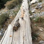
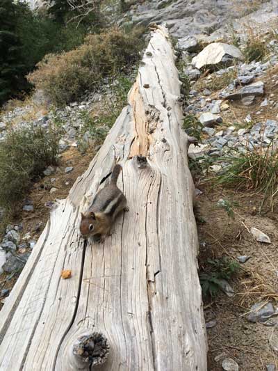
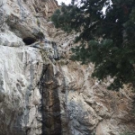
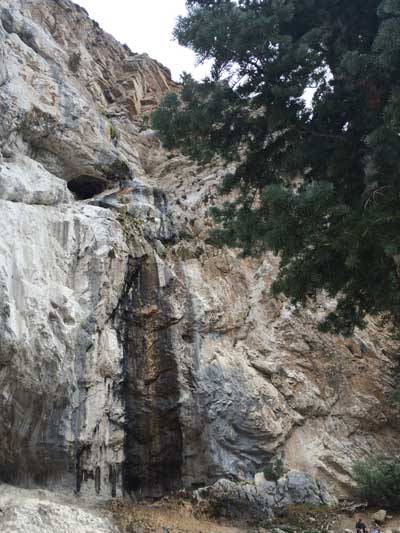
Short but very strenuous (roughly two hours and 100 flights of stairs) hike utilizing switchbacks and stone steps (rip-rap) on a very well marked and heavily used trail. Keep your dogs leashed and under control since a lot of hikers seem to bring their dogs on this one. With a very steep trail, loose rock, and netting in place for erosion control, you definitely don’t want to cut across this trail. Older children can make this hike, but be sure they are used to climbing and high altitude. There is a nice size cave along the north cliff, to the left of the falls; with an easy to follow path leading to the mouth of the cave. From the base of the falls you can see Big Falls to the WSW, and Charleston Peak in the background (snow covered until mid/late Spring). This is a pretty trail with ponderosa pines, white fir, aspen, and mountain mahogany. Look for deer and fox in the aspens at sunrise and sunset, near the beginning/end of trail. Hike early to avoid the crowds at Mary Jane Falls.
I-15 N from Las Vegas to 95 N towards Reno, W on SR 157 (Mt. Charleston – Kyle Canyon) continue past the hotel, 2 miles W of USFS ranger station, to Echo Road. This is where the road curves sharply to the left to head up into old town and the lodge. Instead, continue to the right (almost straight) as it becomes Echo Road. Turn left at the fork (signed) onto the gravel road and park at the trail head. View a Google Map of this Location. There are RR at this parking area and it is also the trail head for Big Falls. Mary Jane Falls is a good trail for the visitor who wants an escape from the casinos and from the desert floor – – it is a short hike and the drive up and back is very scenic. Pack a lunch to enjoy at Mary Jane Falls, but don’t expect heavy water flow over the falls unless it is early spring. LOTS of people use this trail so please pack out any trash you see along the trail, there is a dumpster at the parking area to put it in. (Lat:36.26776 Lon:-115.66295)
-
- Mary Jane Falls Trail Head
-
- Mary Jane Falls Trail
-
- Mary Jane Falls Wildlife
-
- Mary Jane Falls
Designated by the US Department of the Interior as a National Recreation Trail on June 6, 2015, this pleasant 4.4-mile (round trip) trail follows an old railroad bed high above Lake Mead and runs through five 25-ft-diameter tunnels cut through volcanic ridges. With lots of bikers, joggers, and dogs, hiking here isn’t a wilderness experience, but it is a fun walk through historic tunnels in a scenic desert setting.
The “railroad tunnels” portion of the trail starts at the trailhead and runs east to just beyond the fifth tunnel, which runs, literally, underneath the Lakeview Scenic Overlook, but it does not actually connect to the Overlook. From a public toilet, the trail continues all the way to Hoover Dam, adding another 3.5 miles to the round-trip hike.
This hike is located near Highway 93 in Lake Mead National Recreation Area, about 1 hour southeast of downtown Las Vegas. From town, drive out to Lake Mead. Drive south on Highway 93, through Boulder City, to Lakeshore Road. Turn left (north) onto Lakeshore Road and drive north 0.4 miles (just past the Visitor Center) to the large Historic Railroad Trailhead, on the right. Park here; this is the trailhead. This trailhead is outside the fee area.
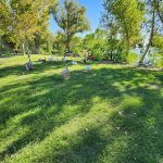
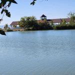
The Floyd Lamb State Park features the Tule Springs Loop, which is a free-to-access trail that interconnects with the greater park area. This area features lakes and grass, historic buildings, level trails, both paved and unpaved, and a mix of desert and green scenery and wildlife.
Location
We meet at the intersection of Racel and Cimarron with ample free parking. At 10:15a, we head out on the trail. The trail is level and even with little change in elevation on our roughly 4-mile loop. We will be in the sun, exposed for most of our time on the trail, so please plan for sun protection, including a hat or umbrella and sunscreen.
As we leave the desert trails and head into the lake area of the park, there are restrooms and water fountains for anyone in need. We plan to spend time in this area and posted info boards share the history of the park and the few historic buildings on the path. It’s common to see the park’s many peacocks and other birds and wildlife, especially in this area.
If you plan to attend a hike, please take some precautions with appropriate footwear and clothing. Wear sunscreen and bring snacks and plenty of water!
For more information about this hike, please visit alltrails.com
Hours
Meet at 10 am. Our hike will last until approximately 1 pm.
Fees
Parking is free.
Directions
For directions using Google Maps, click here. For all others, please search the intersection of Racel St and N Cimmaron Rd to arrive at the correct location.

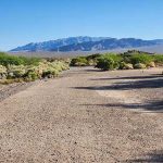
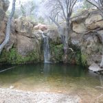
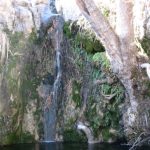
This is a pleasant walk across a desert valley to a little waterfall with cottonwood trees, willows, and other shade trees. Except for the last few feet, the hike follows a well-maintained trail. At the falls, the route follows a use-trail down the side of the wash to the falls. As with other falls in the area, these often are dry.
Location
We meet at the First Creek Trailhead. There is ample parking along the side of Red Rock Canyon Road (NV-159).
If you plan to attend a hike, please take some precautions with appropriate footwear and clothing. Wear sunscreen and bring snacks and plenty of water!
For more information about this hike, please visit alltrails.com
Hours
Meet at 10 am. Our hike will last until approximately 1 pm.
Fees
Parking is free.
Directions
For directions using Google Maps, click here.